Location

Location

September 2, 2021 2023-09-09 0:41

Discover Limenas

Thassos is the northernmost island of the Aegean Sea and is a popular tourist destination while at the same time it is the ideal choice for relaxing holidays. It is an island with award-winning beaches and a long history from ancient times until today.

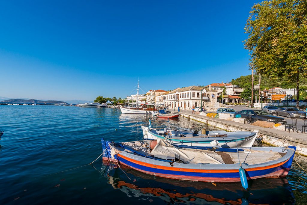
Limenas of Thassos is on the north side of the island and is the ideal choice for visitors who want to combine quality holidays with tranquility and relaxation.  Here there is a wide variety of taverns and restaurants that offer you many different tasty options from the local Thassian cuisine to the international one.  Its beaches are famous and mostly sandy, while its nightlife is intense with several bars, clubs, and cafes.

Directions

Getting here

Thassos island is only accessible by ferry boat and has two ports, Skala Prinos and Limenas (Thassos Town) which are serviced respectively from Kavala and Keramoti on the mainland.

By Car

The fastest route is from Keramoti to Limenas (Thassos Town), with a journey time of just 35 minutes and frequent sailings, every half an hour during the summer, this is the preferred route of many visitors to Thassos.

By Airplane

Thassos does not have its own airport but benefits from the nearby Kavala (Megas Alexandros) airport, from the airport to Keramoti port is a short taxi or hire car journey. Many tourists also choose to fly to Thessaloniki airport (International Airport Makedonia), this is the second largest airport in Greece and benefits from many budget airlines. From here you can take a bus to the coach station and from there, it is a 2-hour KTEL coach ride to Kavala, or hire a car and drive to either Kavala or Keramoti ports.

{"settings":{"zoom":16,"mapTypeControl":false,"mapTypeId":"roadmap","styles":[{"featureType":"all","elementType":"labels.text.fill","stylers":[{"saturation":36},{"color":"#000000"},{"lightness":40}]},{"featureType":"all","elementType":"labels.text.stroke","stylers":[{"visibility":"on"},{"color":"#000000"},{"lightness":16}]},{"featureType":"all","elementType":"labels.icon","stylers":[{"visibility":"off"}]},{"featureType":"administrative","elementType":"geometry.fill","stylers":[{"color":"#000000"},{"lightness":20}]},{"featureType":"administrative","elementType":"geometry.stroke","stylers":[{"color":"#000000"},{"lightness":17},{"weight":1.1999999999999999555910790149937383830547332763671875}]},{"featureType":"landscape","elementType":"geometry","stylers":[{"color":"#000000"},{"lightness":20}]},{"featureType":"poi","elementType":"geometry","stylers":[{"color":"#000000"},{"lightness":21}]},{"featureType":"road.highway","elementType":"geometry.fill","stylers":[{"color":"#000000"},{"lightness":17}]},{"featureType":"road.highway","elementType":"geometry.stroke","stylers":[{"color":"#000000"},{"lightness":29},{"weight":0.200000000000000011102230246251565404236316680908203125}]},{"featureType":"road.arterial","elementType":"geometry","stylers":[{"color":"#000000"},{"lightness":18}]},{"featureType":"road.local","elementType":"geometry","stylers":[{"color":"#000000"},{"lightness":16}]},{"featureType":"transit","elementType":"geometry","stylers":[{"color":"#000000"},{"lightness":19}]},{"featureType":"water","elementType":"geometry","stylers":[{"color":"#000000"},{"lightness":17}]}],"zoomControl":true,"scaleControl":false,"streetViewControl":false,"fullscreenControl":false,"scrollwheel":false,"draggable":true,"center":["40.776166683974196"," 24.69387868205265"]},"marker":[{"position":["40.776166683974196"," 24.69387868205265"]}],"overlay":[{"position":["40.776166683974196"," 24.69387868205265"],"content":"\u003Cdiv class=\u0022nuss-map-overlay nuss-map-overlay- elementor-repeater-item-0f99084\u0022\u003E\u003Cdiv class=\u0022gmap-info-wrapper style-signal\u0022\u003E\u003Cdiv class=\u0022animated-dot\u0022\u003E\u003Cdiv class=\u0022middle-dot\u0022\u003E\u003C\/div\u003E\u003Cdiv class=\u0022signal signal-1\u0022\u003E\u003C\/div\u003E\u003Cdiv class=\u0022signal signal-2\u0022\u003E\u003C\/div\u003E\u003C\/div\u003E\u003Cdiv class=\u0022nuss-map-overlay-template\u0022\u003E\u003Cdiv class=\u0022nuss-map-overlay-content\u0022\u003E\u003Cdiv class=\u0022nuss-map-overlay-info\u0022\u003E\u003Cdiv class=\u0022map-marker-image\u0022\u003E\u003C\/div\u003E\u003Cdiv class=\u0022map-marker-content\u0022\u003E\u003Ch5 class=\u0022map-marker-title\u0022\u003EOlympiada, Chalkidiki, Greece\u003C\/h5\u003E\u003Cdiv class=\u0022map-marker-description\u0022\u003ELatitude : 40.59328 \u003Cbr\u003E\nLongitude : 23.78074\u003C\/div\u003E\u003C\/div\u003E\u003C\/div\u003E\u003C\/div\u003E\u003C\/div\u003E\u003C\/div\u003E\u003C\/div\u003E"}]}
Relaxation

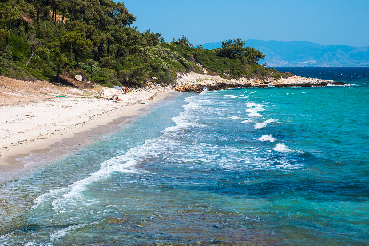
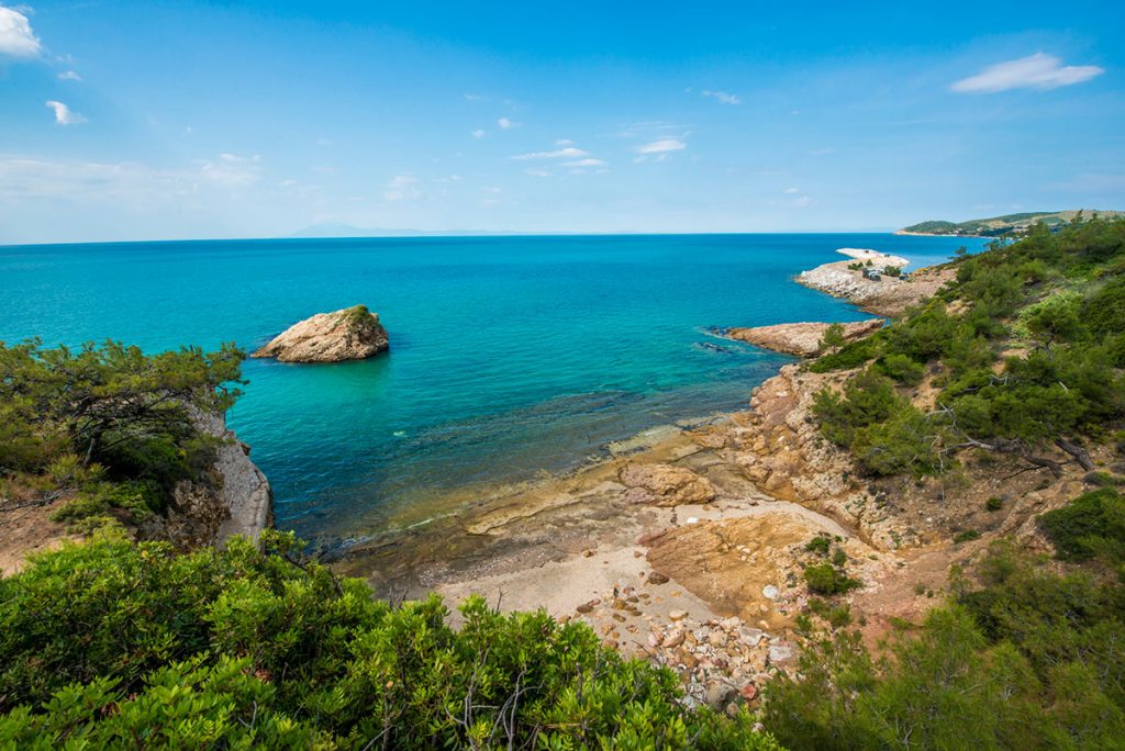
Breathtaking Beaches

Thassos is littered with dozens of amazing beaches and hidden coves all over the island, renowned for their crystal clear waters.
Every visitor will find a beach of his liking to relax & enjoy, whether it is a sandy or a pebble one.

The beauty of the island is undisputed and is considered one of the most diverse and beautiful islands on the Aegean sea.
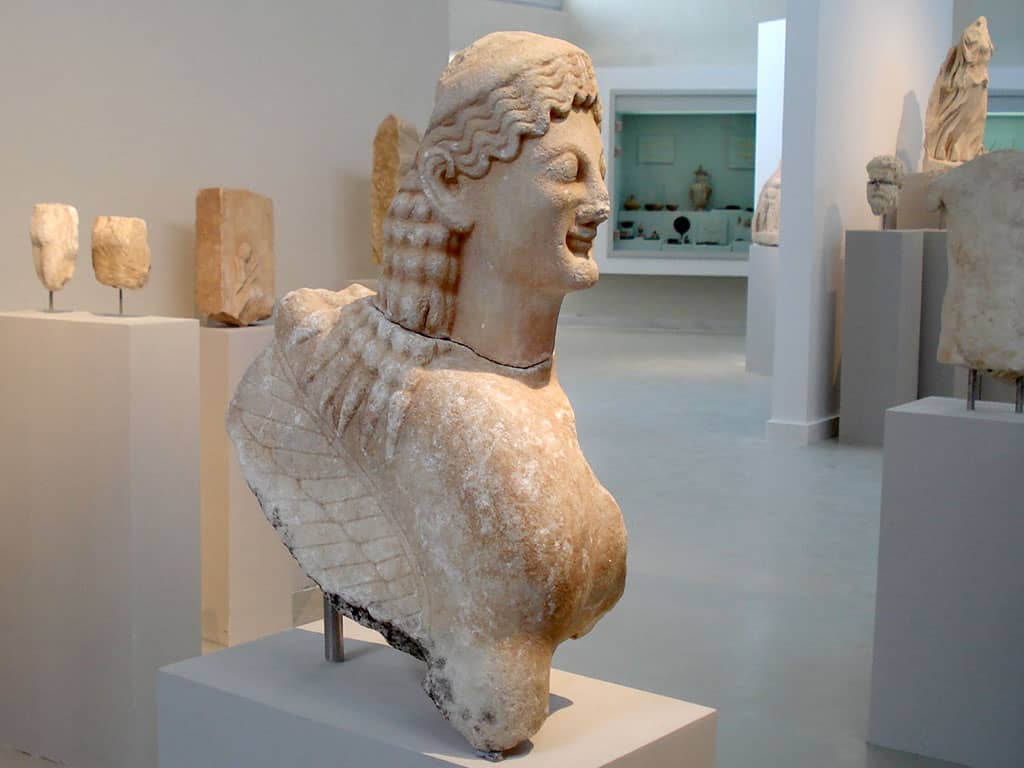
History & Culture

Sights and Museums

There are various archeological & cultural sites throughout Thassos island but we recommend a visit to the archaeological museum.
 
The museum is considered one of the most important museums of the area, it exhibits collections of archeological finds from the 7th century BC to the 7th century AD.

Important findings from the Paleolithic to the Roman era paint a vivid picture of one of the most important Aegean civilizations.

ESPA